Lyft Uses Mapping Intelligence to Reduce Friction in Gated Community Pickups
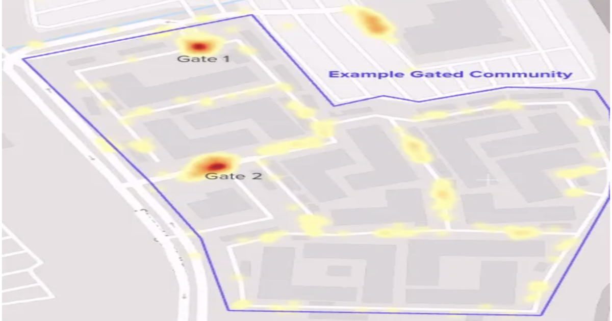
Lyft details a new pickup experience to improve reliability in gated communities, where 25–30% of rides face routing and access challenges. The system uses mapping signals, boundary detection, and routing improvements to reduce cancellations and coordination overhead between riders and drivers, highlighting how real-world constraints drive evolution in geospatial systems. By Leela Kumili
The increasing complexity of urban environments and the growing reliance on location-based services are pushing companies to invest in more sophisticated geospatial intelligence.
This highlights the continuing evolution of geospatial systems and their critical role in optimizing real-world logistics and reducing operational friction for large-scale service providers.
Lyft's specific problem-solving approach demonstrates how detailed mapping intelligence and boundary detection can be integrated to enhance service reliability in challenging environments.
- · Lyft
- · Geospatial Software Developers
- · Platform Engineering Teams
- · Gated Communities
- · Inefficient Routing Software
- · Generic Mapping Solutions
Reduced cancellations and improved driver-rider coordination for Lyft in specific problem areas.
Increased investment by ride-sharing and delivery companies into hyper-localized mapping and access solutions for complex delivery situations.
The development of standardized protocols or AI models for dynamically negotiating access and routing in private or restricted areas, impacting urban planning and last-mile logistics.
This signal links to a primary source. Continuum Brief monitors and indexes it as part of the live intelligence stream — we do not republish source content.
Read at InfoQ